
10.09.10
I left Nassan’s early, about 7:30 … but it was still after 8pm by the time I had left UB. Traffic again was bad. Had I been an hour later it might have taken me 3 times as long to get out of town. Now out on the clear road, I refuelled and stocked up on water and bounty bars. I notice the damn rear tyre I was carrying was a massive pain the nuts. I had it heavily over to one side. I didn’t want any chance of it being damaged by the exhaust gases. But on the high speed rough roads I had been riding yesterday, the tyre had broken off my right rear indicator light. Cest la vie … who needs indicators in Mongolia anyway. But the bigger problem was somehow that damn tyre had knocked off, or unscrewed or broken my X-tank fuel tank lid. It was gone … I just had a gaping filler neck – now full with fuel. I had to figure a way to deal with it. I grabbed a scrap piece of plastic by the fuel station and an elastic band and wrapped the plastic over the open neck, before punching a breathing hole in it. I rode off.
As is often the case with me, I spotted locations I had seen before … on earlier trips … and took pictures of the same scene again … here is a comparison of a 2010 foto with a picture from the Tokyo to London Project, 1994.
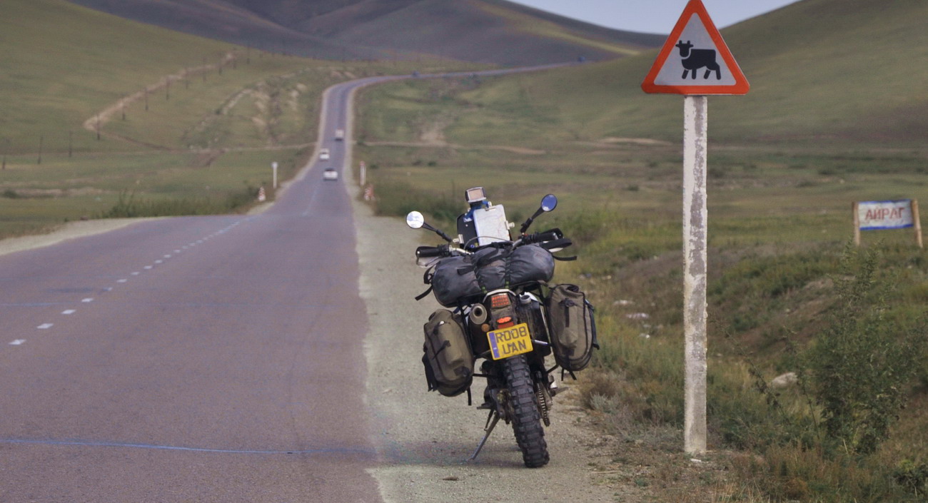
60 km out of UB, I stopped in a roadside village. I saw a tyre changing guy. I took my bags off, ripped the back wheel out and handed it to him with my spare tyre to swap over. While he did the tyres, I changed by wheel bearing seals. I also noticed my elastic and plastic over the fuel tank didn’t work. They were gone. I was back to a gaping filler neck. I took another piece of plastic another rubber band – this time tying it tighter.
By 10:30am I was back on the road. The bike felt much better now that I was no longer carrying a spare tyre. Now it was all business. I refuelled and turned off the main northern highway just before Darkhan, at midday. Again I just had a gaping filler neck at the back. I needed a better solution than elastic bands. I opened a pannier and took out a spare Touratech strap (that had been used for the tyre holding duties but was now unemployed) and found some plastic by the roadside. I strapped it tightly and firmly down over the filler neck. This cant come off now.

I was on asphalt all day so far, and cruised into the big mining city of Erdenet about 2pm. I refuelled and headed into the centre of town for lunch. I was making good time. I didn’t have the details with me but reckoned I had 200 km to go to my target for the day, Moron. I found a pizza joint and grabbed my maps and went inside. While I waited for my pepperoni pizza, I consulted my maps and realised I had badly miscalculated. Moron was still 420 km away. I had less than 100 km of asphalt left. Damn … that’s at least 6 hours of riding … assuming it was all daylight. I didn’t have 6 hours of daylight left. So it will be more than 6 hours. I kicked myself for taking it too easy that morning. I had been cruising along, stopping to take loads of pictures. Stopping at several shops for refreshments, taking my time with the tyre change … even coming into town for a pizza. If only I had known!
I was tempted to wolf down the pizza when it came, run to the bike and charge off. But the pizza looked good. Surprisingly good for Mongolia. I decided to savour the pizza. I would get to Moron when I got there. I wouldn’t get pizza like this there, that’s for sure.
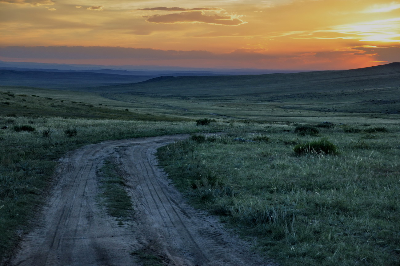
It was 3pm when I left Erdenet. First stop was 200 km down the road at Khutag Ondor … I decided I would grab some fuel there. Then press on. When the asphalt ran out I was disappointed. The earthen roads were not like in most parts of Mongolia, large open fast sections where 100 km/h and more is possible. They were twisty turny churned up sections, where it was difficult to do more than 70 km/h. It was rugged county here and I stopped often for photographs. I wasn’t planning to stop for any pics when I left Erdenet … but the scenery compelled me to stop every now and again and shoot it.

I refuelled at Khutag Ondor and pulled out of town at 5:30 pm. It was still 225km from here to Moron. At 60 km/h that would be nearly 4 hours. Darkness will come about 8:30 … actually maybe 15 – 30 mins later now that I am a fair was West of UB. I would have at least half an hour in darkness … maybe more.
The scenery was spectacular, but I had a new problem. The sun was setting in my face. Dead ahead. I was squinting severely for over 2 hours. By the end of it, I could barely hold my eyelids open. The eyelid muscles were all crapped out. Its dangerous riding into the sun when you are riding against the clock. There is no detail. No contrast, no colour. Many times I whacked into large rocks, or sudden dips that I hadn’t seen till the last minute. I was grateful for the A60 rim. If the rim survives today, its an amazing piece of hardware.
The sun dipped behind the mountains about 8:15pm … I still had 80km to go, and only about 30 minutes left of daylight. With about 40 km to go, it was dark. I switch my second headlight on and stared ahead into the wide pool of light, with terrain rushing past me at 60 km/h. 10 minutes later I realised I was off track. 3km off track. I had been staring into the pool of light too intensely and not checking my GPS. Damn. It was time for an adventure. Between me and the correct track 3km away was a small mountain range. I decided to go direct over it … in the dark. The things you do for kicks in Mongolia. It took me a good 10 -15 minutes to get back to the road, and I have to say it was probably not the smartest decision I ever made, going cross country over the mountains, 40 km from the nearest town, in the dark.
I cruised into Moron at 9:30pm, the last 6-7km were even asphalt … woo hoo!. It had been a huge day. Just under 800 km (500 miles). In the very centre of town I found a hotel … called the 50 – 100. Moron is about 50 degrees North and 100 degrees East. I grabbed a room, had a shower, then took my laptop into the restaurant for beef and beer … it had been yet another day where the last few hours all I had been thinking was … “mate, you have earned the beers that will come at the end of today!”
– – –
11.09.10
After the huge day on the bike yesterday, I decided I deserved a sleep in. I didn’t get out of bed till 9am … then sauntered into the breakfast room. I came back to the room and blogged a bit. By the time I had eaten, packed up, gone to the bank, loaded up the bike and then refuelled it was 11:30am. I didn’t have too much in the way of targets today. After yesterday, I was going to take it easy for a day.
The first 50 km seemed like hard work. I thought at this rate I will struggle to do 250 km today, but as my brain slowly started to wake up, the speed picked up and so did the aggression in the riding. I stopped for lunch at 2:30, having done a little over 200km at a place called Tsetserleg. I had stayed the night at a different Tsetserleg last year. There are a lot of Tsetserlegs in Mongolia. Names tend to be reused a lot. Decent octane fuel was proving hard to come by. I threw 5 litres of 80 octane in the tank at Tsetserleg and I would have to put more 80 in a bit further into the day too.
Over lunch I took a look at my maps … Baruunturuun seemed like an optimistic target. It was still 300 kilometres away though. As a back up I though Tes or even Bayantes would do if progress was slow.
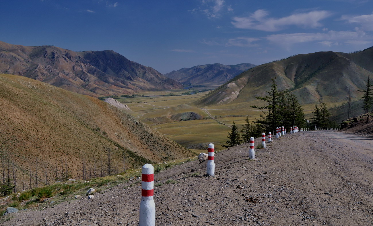
Again it was a day of great scenery. This northern route across Mongolia weaves its way in and out of mountain ranges and while it’s a lot harder going than the simpler southern route, the scenery is worth the speed tradeoff.
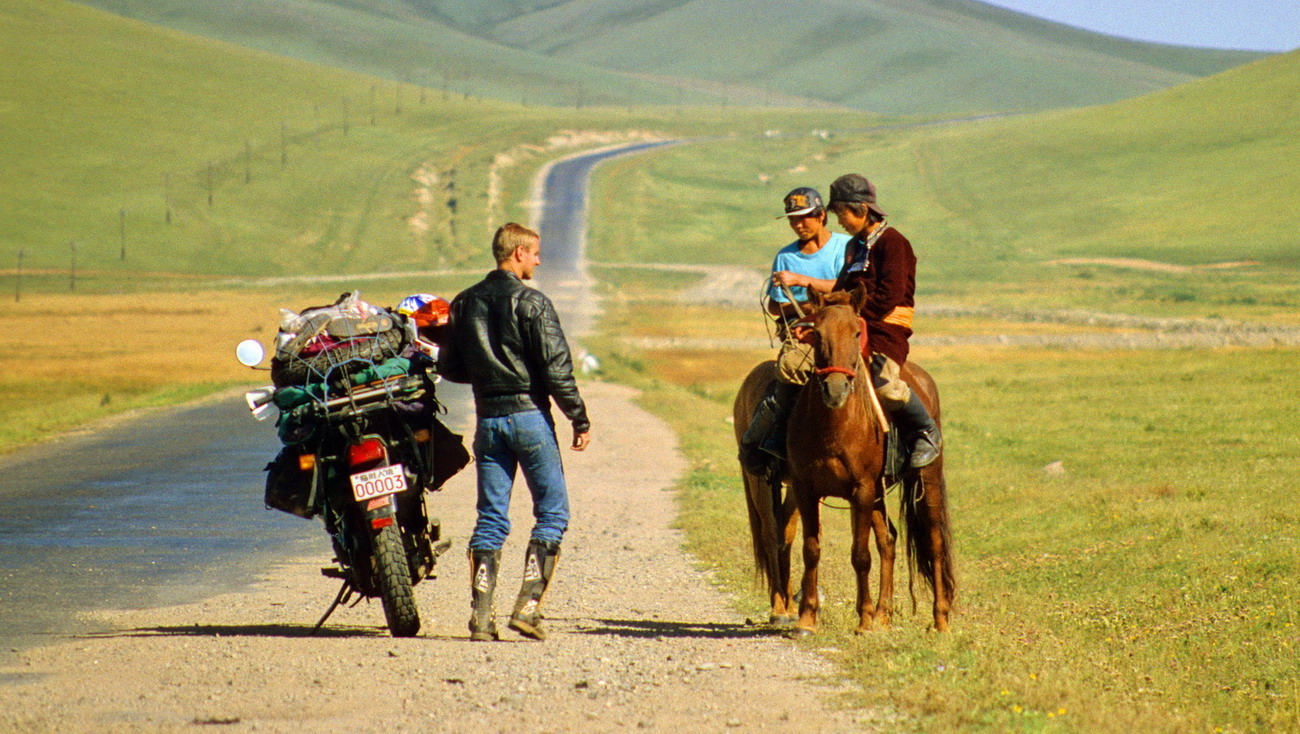
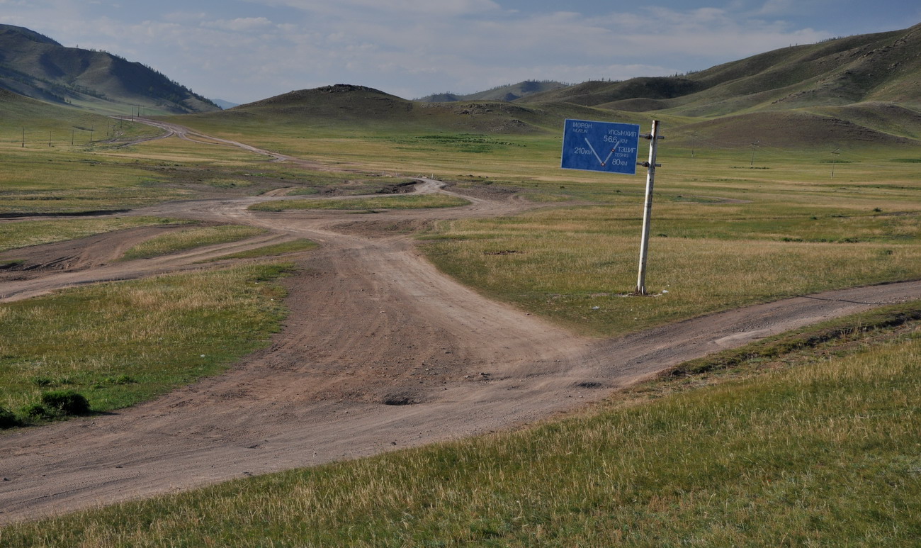
I managed to get off track again today. Despite having the best possible map of Mongolia in paper form, and probably the best GPS maps of Mongolia, they are still only partially accurate. If they are both inaccurate in the same place, then there is nothing accurate to go by. There is one rod marked on both the atlas and my GPS that I swear doesn’t exist at all. So I couldn’t take it then, could I. I did so freelance navigation for about 60 km … just following tracks that went roughly where I wanted them to go, till I reached a town. From the town I was on a known route and normal service resumed.
Despite the one getting lost incident, progress was generally good, and I managed to average about 70 km/h … which on some of the roads today was very good progress. The sun went down soon after 8pm, and I was only 30 km from Baruunturuun . I made it into town in the twilight. By the time I went searching for a hotel it was dark. I found a guesthouse of sorts, for 5 quid a night, had a meal cooked up for me and sat back with a couple of Jalan Khar beers.

I’m just tickled you found a town called Moron!