Crossing the Rubicon

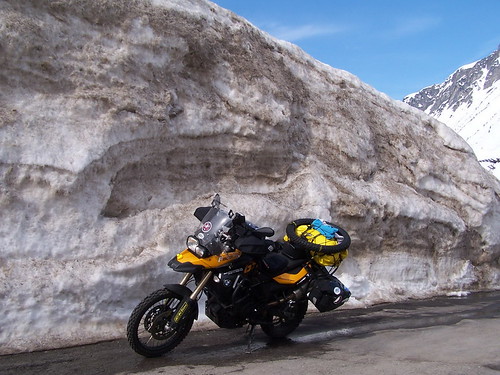
The day started with a lovely 45 minute ride along the Eastern shore of Lago Garda, before heading in as straight as possible a line for Ancona port.  There were only two things to distract us in our mission to get to Ancona in time to buy some ferry tickets for the overnight boat to Split, Croatia.

First of those distractions was just to the north of Rimini … We came across the Fiume Rubicone … otherwise known as The Rubicon.  This pathetic unremarkable stream once marked the border between the Roman provinces and Italy proper.  The expression to cross the Rubicon is in reference to Julius Caesar, who invaded Italy by crossing the Rubicon with his legions.  Generals were supposed to re-enter Italy “unarmed”, but Caesar crossed with his legions, and in doing so, launched the Civil War against the Senate and its army – a war in which Caesar eventually won – becoming dictator in the process.  So today, WE crossed the Rubicon .. not figuratively, but literally!.

The second distraction of the day was San Marino.  A short side trip up to a mountainside fortress enabled us to claim our 11th country of the trip so far.  The Garmins both went a little crazy on the way back down  … maybe San Marino is a GPS black hole.  or maybe garmin is crap??

Finally we pulled into Ancona port, bought the tickets for ourselves and the bikes to Split and headed off to find the internet cafe … where we sit right now.!

Tomorrow we wake up in Croatia.  Bona Sera !

Crossing the Alps

Thursday started off freezing.  Wednesday night was our first night in the tent, and while it was a balmy +15 degreees when we pulled into Liechtenstein late on Wednesday afternoon, it was icy when we woke in the campground the next morning.  The sort of damp cold that penetrates everything.  Even our super warm Khyam sleeping bags were unable to cope with this damp sub zero cold and I had no choice by to head for the showers at 6am, frozen to the core, for a half hour long scalding hot shower just to warm up.

We packed up camp and hit the road eventually about 10:30 all set to face the Arlberg region of Austria.  It was still only 1 degree above freezing.  We had two passes to deal with today:  the Brenner Pass was the main one.  At 1370 metres its one of the lowest but most important crossings in the whole Alps.  We had been stopped and told by a swiss motorcyclist the previous day that passes over 1400 metres still have snow and ice on the road surfaces.  But the Brenner was so important to European commerce that it was bound to be open.  We were less certain about the Arlberg Pass.  At 1800 metres, we thought it would be closed and we would have to pay the big bucks and use the Arlberg tunnel to cross from the Rhine basin to the Danube basin.  But we were in luck. Austrian alpine signs proclaimed the pass open, and I said to Jonathan that if the pass was open, it behooved Sibirsky Extreme to take it on.

And so we did.  Long before we got to the pass we passed the village of Stuben, at around 1300 metres on the west side of the pass.  Stuben is a ski resort village part of the whole Arlberg complex, and sure enough we were riding passed stunned skiers, staring wide eyed as we rode up the mountain while they skied down it 5 metres away from us.  The pass was clear at 1800 metres and at that point we were a full 500 metres above the bustling ski resort of St Anton.  We descended the Eastern side of the pass only to find someone had already Sibirsky Extremed the St Anton sign!  Damn, we were too late again!

A couple of hour later, atop the Brenner Pass,  Jonathan stopped for a chat with Humphrey, an English cyclist who was off to China … it had taken him a whole month to get to the Brenner.  Good luck Humphrey.

Then it was Italy, and country number 10.  Weather was instantly shite on the Italian side.  Moist air pushing up on the alps … we pressed on in light rain to Lake Garda, where we found a bike friendly Hotel for the night.  We were in luck for there was a cheezy Tex-Mex place across the road and we feasted on Burritos and long overdue beers.  The idea of camping in the rain kinda sucked – so to find a bike friendly hotel where we could park the bikes in an underground garage was a nice end to the day.

DE, CH, FL, AT

It was 1 degree when we left Enzklosterle this morning, but we have managed to end the day in warm sunshine in Austria, having entered our 9th country.  So far GB, France, Belgium, Holland, Luxembourg, Germany, Switzerland, Liechtenstein and now Austria have been visited by the Sibirsky Extreme motorcycling bandwagon. (I dont think Wales counts as a separate country does it??)

Tomorrow, Italy should be country number 10.

We are camped in the Rhine valley, surrounded by Alps on all sides here … so far we have avoided the mountains (though there was plenty of snow in the Schwarzwald this morning above 600 metres … we did a lot of riding 800-900 metres amsl) but tomorrow does worry mee a bit.  We cross the Alps at one of the lowest points, the Brenner Pass (about 1300 metres from memory) but we have to get through the Arlberg first.  The Arlberg pass is still closed I think so we have to pay the big bucks and use the tunnel.

Someone seems to have got wind of our little project and we have been finding Sibirsky Extreme stickers all along our route, including border crossings and customs buildings!  I cant believe people would do such a thing!.

I hate garmin

Well another day and another set of Garmin Zumo malfunctions.  I have never been a huge user of GPS units but I thought times they are a-changin and I should change with them.  So I got me a Zumo a few months before going away.  Riding around the UK it worked just fine.  Faultlessly in fact.  So I headed off for the other side of the world, imagining I had a functional GPS from the most expensive brand of GPS units on the market.

Day 2, cross over into Europe and I found I had no detail in my maps.  It seems though my GPS came with maps of Europe, I had to manually copy them from my laptop to the unit.  So I did that in the evening and solved that part of the problem.

Day 3, and the route I had prepared and copied into the Zumo taking me from Calais to Ancona is determined by the Zumo to be too large and complicated.  It did tell me this when it first loaded  the route, but also said it would update and recalculate the route as I went through it.  But no.  The retarded unit decided the route is too large for it to handle full stop.   So all my efforts to create a route from Calais to Ancona were wasted.

Day 4, … overnight I had prepared a couple of smaller 1 day long route sections to get me between the Black Forest and Ancona … and uploaded them into my Zumo … an Jonathans Zumo 400.  Jons Zumo took them easily.  My Zumo imported the user data route 9just as Jonathan’s did) but  when i went to look for the route i just uploaded, there was nothing there.  Just a couple of old routes – and the useless route to Ancona from Calais.

If there are any Zumo wizards out there to help me understand why my Zumo is so dysfunctional, I would love to hear from you, before I throw it overboard.

Jon is doing most of the navigating at the moment, with routes that I have prepared … as I am able to tranfer them and import them into Jon’s Zumo, but despite my Zumo saying it has transfered and imported the data successfully, the route is not showing up in my routes.

Day 3

Day three – Widooie (Tongeren) to the Schwarzwald

We said our goodbyes to to Thierry, Francoise and Norbert around lunchtime and bid farewell to the castle in Widooie. It was a perfect day of wall to wall blue skies and sunshine as we rode the few short kilometres to Holland and Maastricht. Even at this early stage we were beginning to notice discrepencies in how our resepective Sat Nav’s calculated the route. Mine was less problematic although  the garmin’s propensity to tell you to turn left or right after the actual turn was really making navigating hard work. Walter’s sat nav gave up after a short time and drew a single ‘as the crow flies’ line across Europe to Ancona. We decided at this point to enter smaller towns that we knew en-route. As it happened the route we took was very picturesque and great fun on a bike.

For anyone that is looking for small foray onto the continent you could do a lot worse than head down to the Belgian Ardenne. We also took the opportunity to stop at the Spa – Francorchamps race track that is used for the Belgian Grand Prix tucked away in the Belgian Ardenne. I have this thing about the Saarbrucken triangle. It’s like the Bermuda triangle except the only thing that goes haywire is the garmin. It sent us around in circles and the only way out was to use the Autobahn. Eventually we managed to get off the autobahn and continue from Luxembourg into Germany, then France and back into Germany.

We arrived into Baden Baden around 9pm. Baden is a very wealthy town and there were casino’s and spa’s a plenty. Not the sort of places for two grubby bikers. We set the sat nav to seek out a campsite and in no time we were headed into the forested hills for a campsite that was 19km away. The 19km turned into 22km and then we we stopped to double check the route the sat nav said 15km to go. We should add that it was pitch black, the road had snow at the edges and there were many switchbacks.

Eventually we reached the town of Enzklosterle deep in the heart of the German Schwarzwald and after a few failed attempts to find a room we managed to find room at the Inn and some food despite it being after 10pm.  But sadly no internet.

Going where no motorcycle has been before